Mount Fosthall
- 2686m (816m prominence)
- Monashee Mountains, Gold Range
- Monashee Provincial Park, BC
There are two standard ways to do Mount Fosthall, both gaining the south ridge from the south east.
- The easiest is probably to start at the Sol Mountain Lodge from the east, taking the South Caribou Pass Trail to the Mount Fosthall route. This shouldn’t be much more than 1000m elevation gain, and is much shorter than the other route.
- The other way is to start from the Spectrum Lake trailhead to the west, taking the long way around the mountain before meeting up with the Mount Fosthall route. Out and back, this is a 39km route with 2300m of elevation.
Because the Spectrum Lake trailhead was 2 hours closer by car and also offered more of a challenge, the choice was easy.
The Spectrum Lake trailhead is easy to get to on well maintained forestry service roads, so no 4x4 vehicle is required. Coming from Cherryville, I took the FSR north along and past Sugar Lake. Then the Sugar-Spectrum FSR took me east across the river, back south, and then east to the trailhead. This was all well-marked, I just had to follow the signs to Monashee Provincial Park. The trailhead was busy when I got there, with about 30 cars. It’s hard to miss.
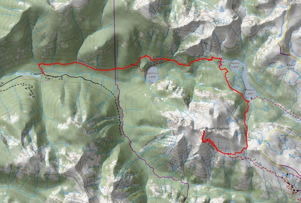 Mount Fosthall via Little Peters Lake
(gpx).
Mount Fosthall via Little Peters Lake
(gpx).
The first section is about 5km and 200m gain on well maintained trail to a fork, where right takes you to Spectrum Lake (popular for camping) and left takes you directly to Little Peters Lake.
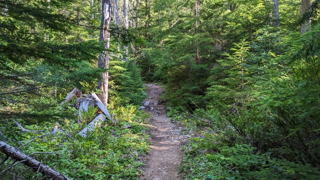 Well maintained trail through cedar forest.
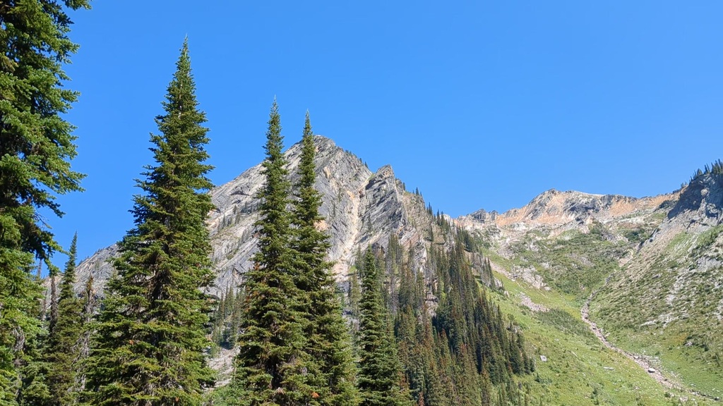
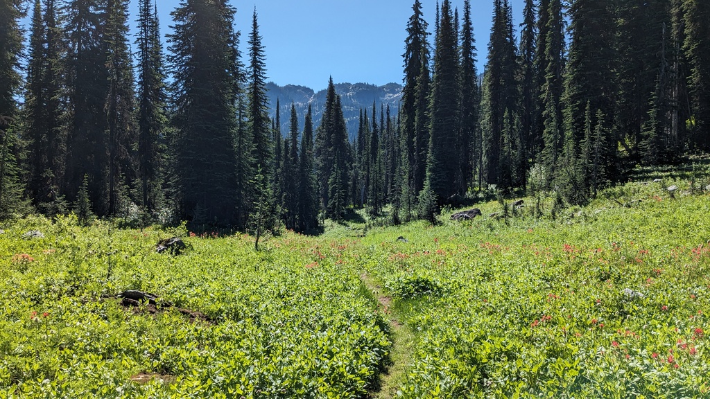
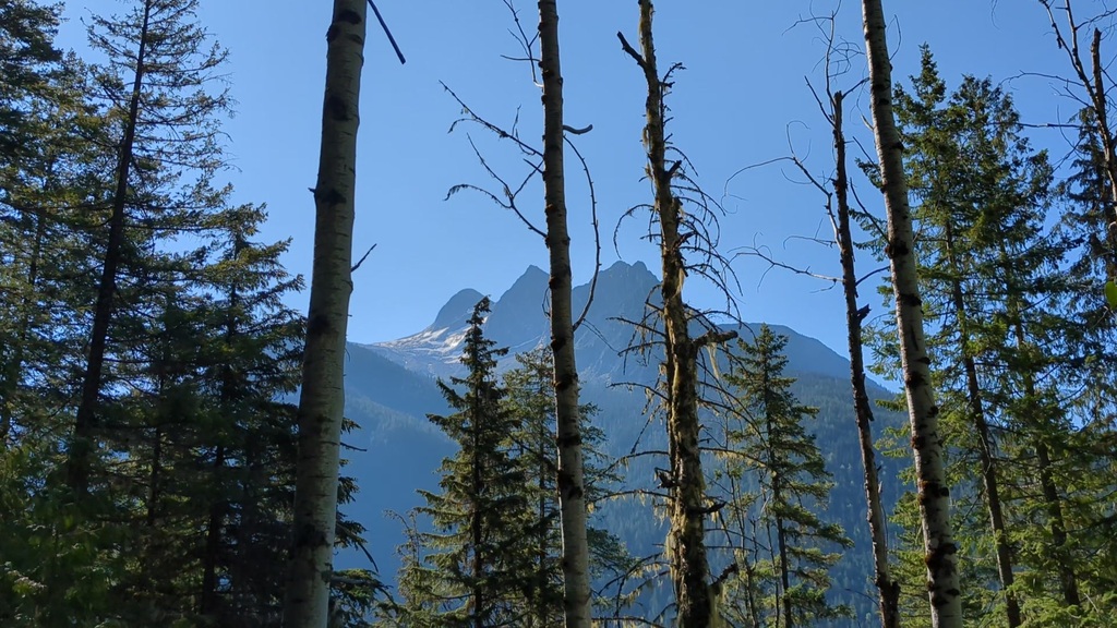 The summit is on the left, visible whenever the trees opened up.
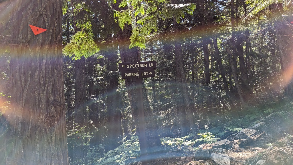
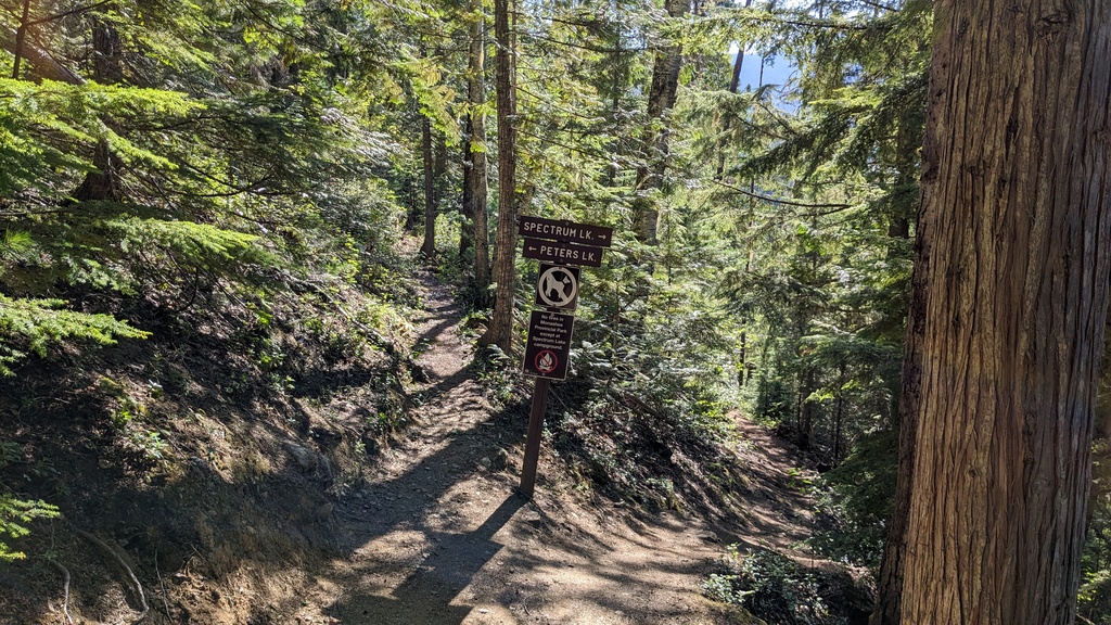 A fork in the road.
The next section to Little Peters Lake is a bit under 6km, but packs quite a bit of elevation, between 700 and 800m. Once at the top, the forest opens up and Little Peters Lake appears. There are a few campsites here, toilet and a bear cache. This was a Saturday morning in July, but I only saw one tent up there.
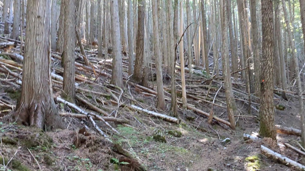 Lots of deadwood here.
 From this angle, the summit is nearly obscured but still visible in the middle.
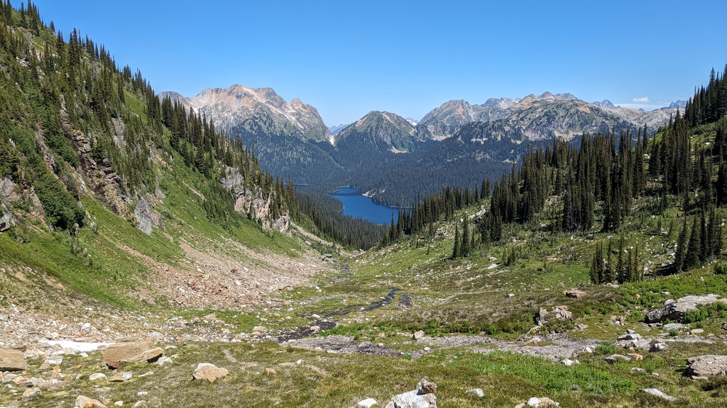
 A good view of Slate Mountain, visible from Little Peters Lake.
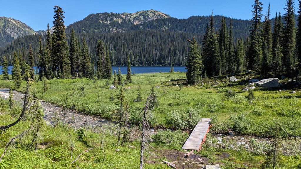
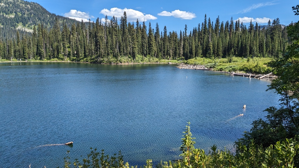
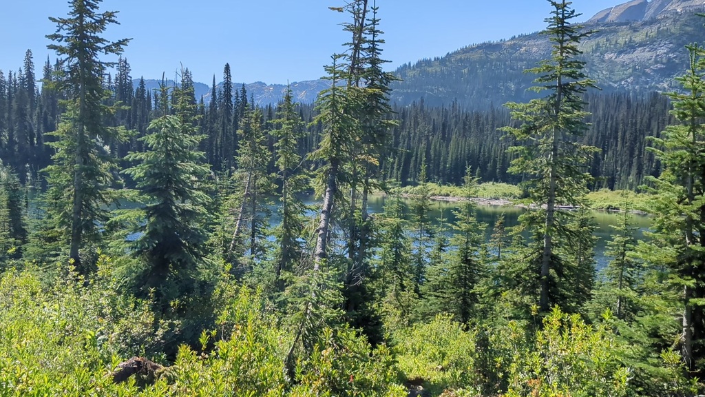 Little Peters Lake.
Shortly after Little Peters Lake, I crossed the creek that drains the lake. The bridge here was heavily damaged, but there are a few options for getting across without getting your feet wet (even though these are discouraged by the sign at the trailhead). The next section was a pleasant 3km+ stroll through nice meadows and forest with little elevation gain, until the south end of Big Peters Lake appeared on the left. There was a bridge here that leads to some more campsites and a trail to Margie Lake.
 The meadows were nice.
 Big Peters Lake. Apparently there is more camping here; I didn’t cross the
bridge to look.
Big Peters Lake. Apparently there is more camping here; I didn’t cross the
bridge to look.
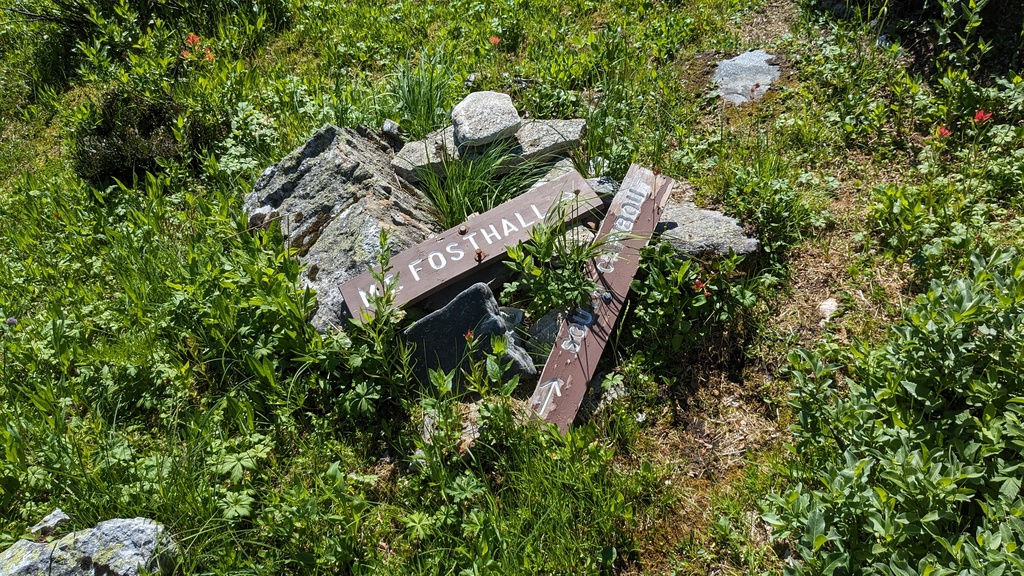 The signs around here were no longer standing, but this is a fork.
At the bridge and fallen signs, the route splits in two, even though the trail leading to Mount Fosthall disappears here briefly. I carried on south without crossing the creek, and quickly regained the trail. It follows a contour along the eastern slopes of the mountain, until it meets up with the creek once again. Here the valley narrows and steepens. The trail was a bit difficult to follow here at points, but it didn’t really matter since the direction was obvious—just go up to the saddle between Mount Fosthall and Visionary Peak.
 More nice meadows, although slower to traverse.
 Looking back at Big Peters Lake halfway up to the saddle.
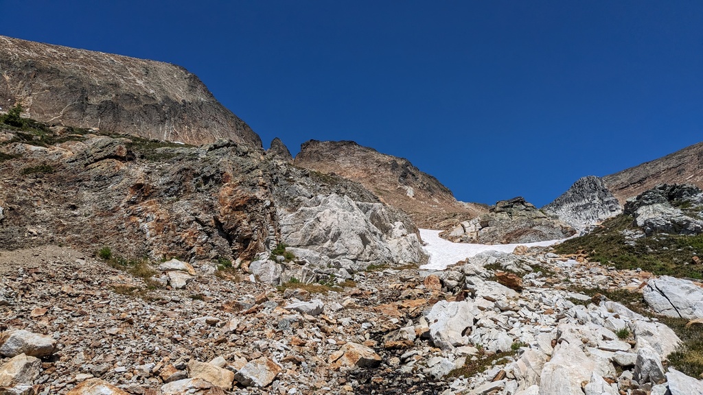
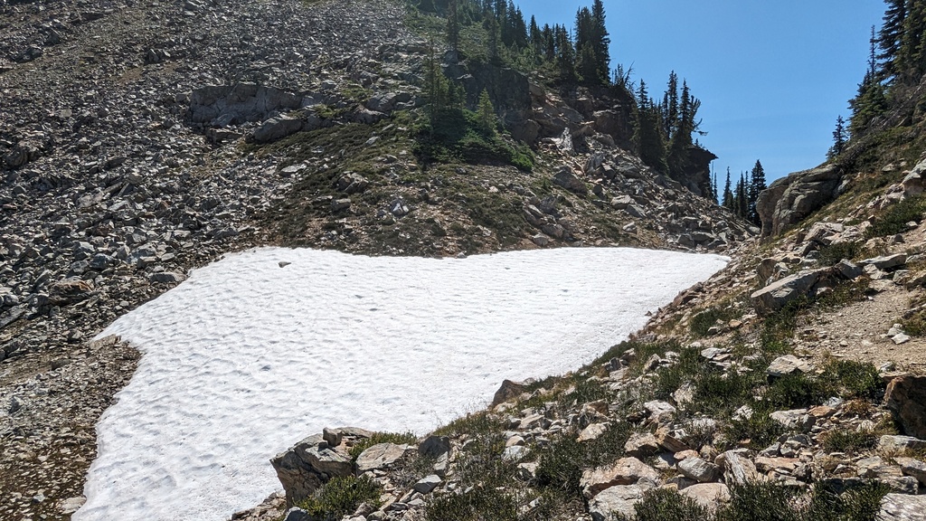 Not much snow along the route at all.
After a tough gain of 400m I was up on the saddle, with gorgeous views of the alpine opening up in front of me. The trail was once again good quality here, and snaked around the south east side of the mountain to meet up with the South Caribou Pass Trail and the Mount Fosthall route.
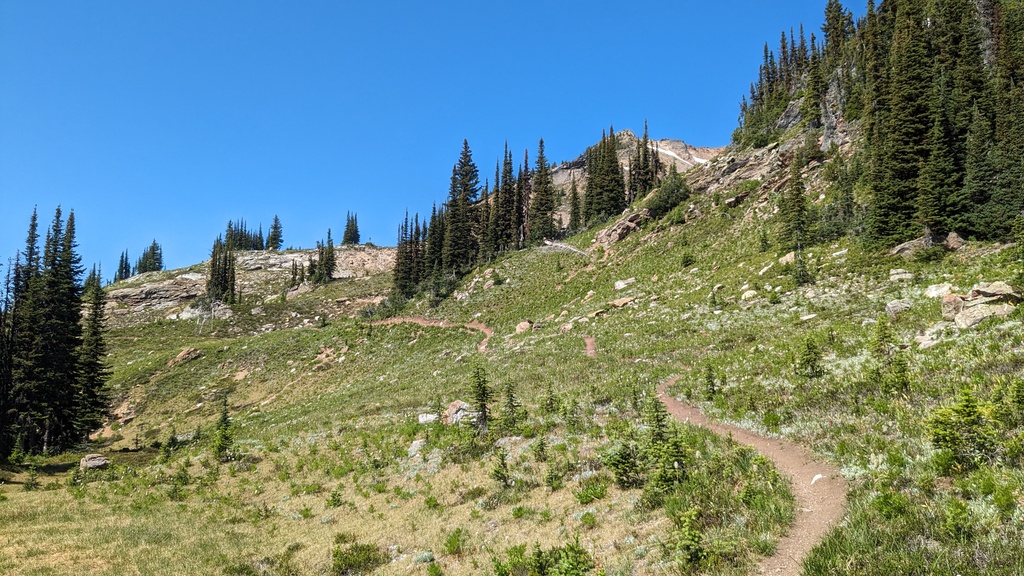 Good quality trail and a bit of a break from elevation gain.
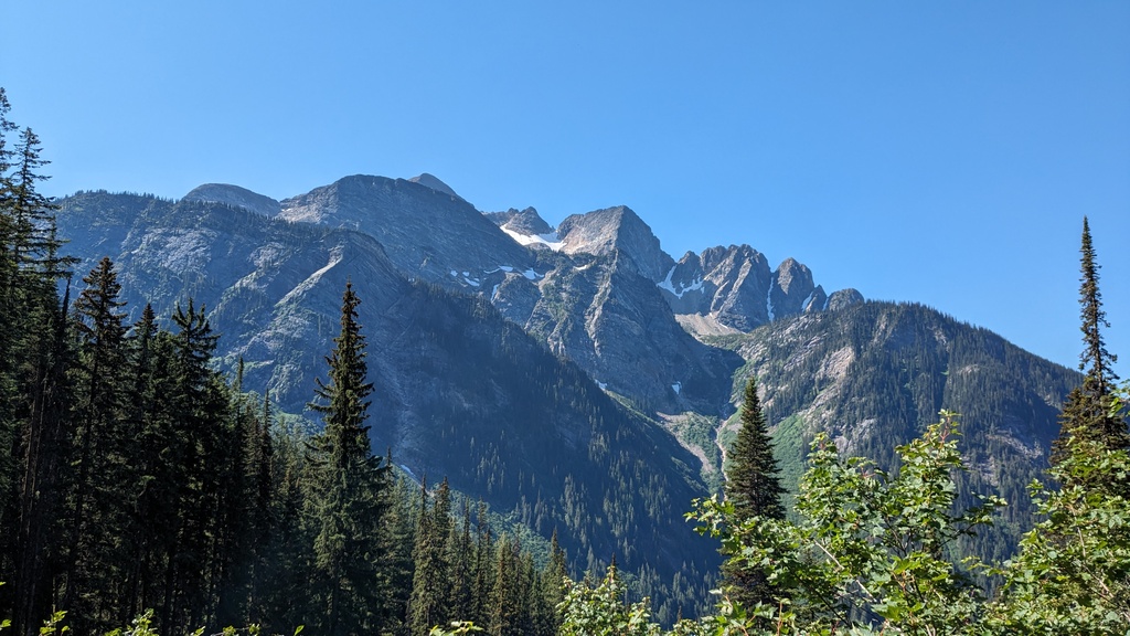
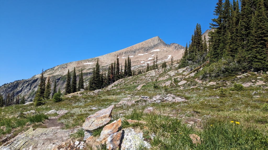 View of the summit. Looks pretty straightforward. The ridge would be gained in
the lighter colored section in the middle.
View of the summit. Looks pretty straightforward. The ridge would be gained in
the lighter colored section in the middle.
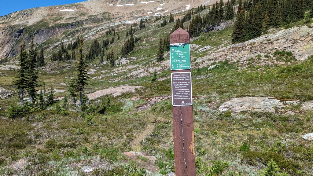 This is where the South Caribou Pass Trail meets the Mount Fosthall route.
The trail on the Mount Fosthall route was only visible for a kilometer or so, after which the GPX track started going uphill and the trail largely disappeared. At this point I had already accumulated about 1600m of elevation gain and was pretty worked. So I slogged diagonally up the slope to the left, over low lying vegetation, scree and sand. There were a few patches of snow and some gullies, but they were easily avoided or traversed. I could see two people much higher up, about to gain the ridge. I sped up a bit and caught them as they made it on to the ridge. This was probably the only “difficult” part of the route, with the scree being a bit slidey. I opted to just go straight up. Once on the ridge itself, it was steep but technically easy, with the rocks being large enough not to slide. The last few hundred meters were slow going, but eventually I made it to the summit. There was little wind, so I took my time to soak in the views and eat some food.
 This slope didn’t really have a trail and was a slog, but not technical.
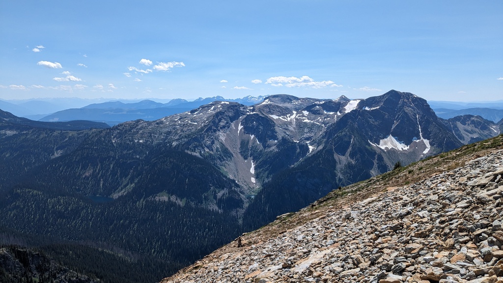
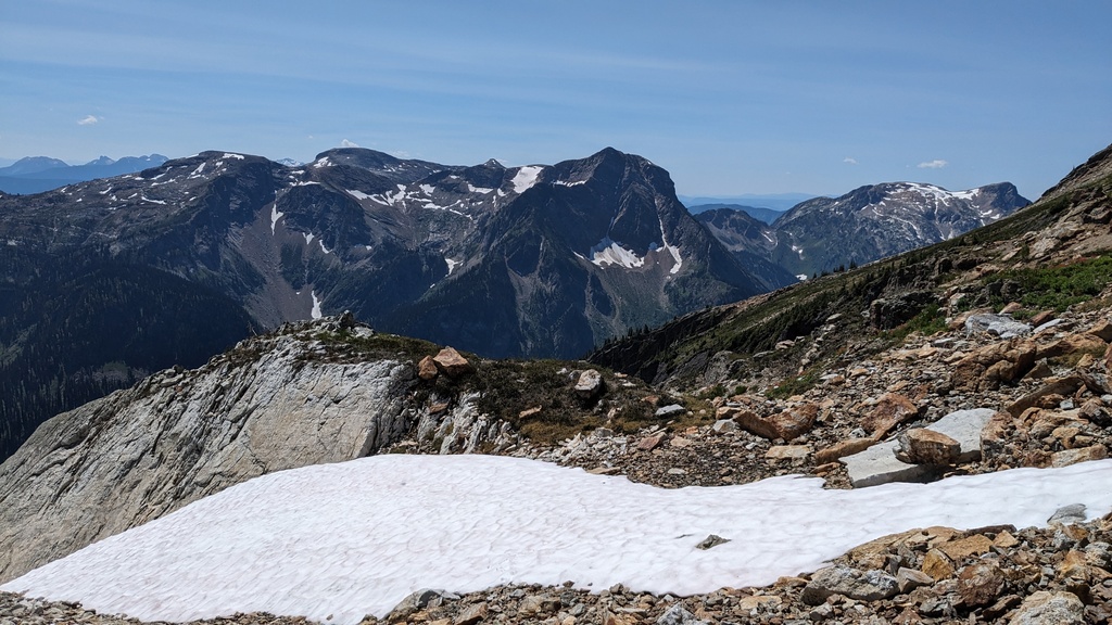 Views to the south, with Initiative Peak in the middle, and Integrity peak to the left.
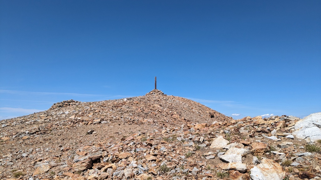 Summit finally in view.
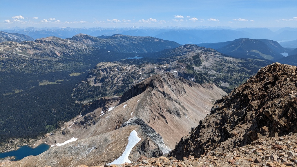 The east ridge of Mount Fosthall. There aren’t too many impressive features
this direction.
The east ridge of Mount Fosthall. There aren’t too many impressive features
this direction.
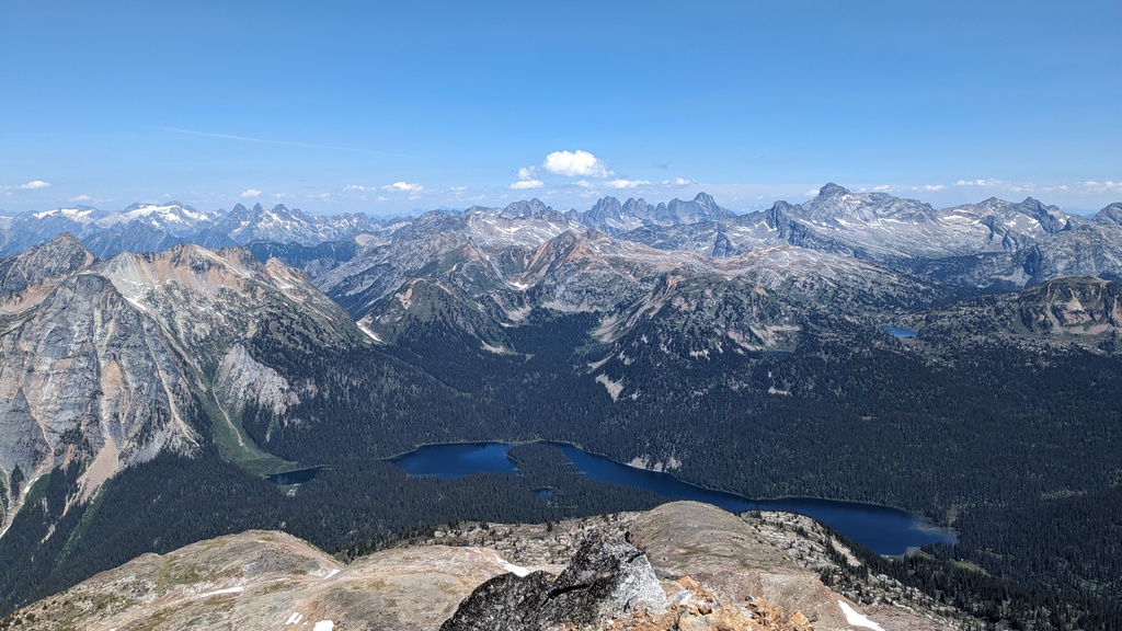 The view north is much more impressive. Slate mountain on the left. The high
peak on the right is Mount Odin (highest of the Gold Range), and to the left of that you can see Mount Thor’s jagged peaks.
The view north is much more impressive. Slate mountain on the left. The high
peak on the right is Mount Odin (highest of the Gold Range), and to the left of that you can see Mount Thor’s jagged peaks.
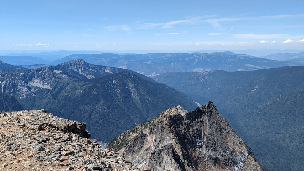 The west ridge of Mount Fosthall. In this direction, the mountains disappear
into the Okanagan highlands.
The west ridge of Mount Fosthall. In this direction, the mountains disappear
into the Okanagan highlands.
 Another view south on the way down from the summit. The summits in the
distance are the Pinnacles.
Another view south on the way down from the summit. The summits in the
distance are the Pinnacles.
On the way back down I passed the couple I’d seen on the way up, one half of who was still struggling on those final hundred meters. The way down was uneventful and a bit of a slog because I was tired. It took about 2 hours to get back down to Little Peters Lake, and another hour or so to get back to the car.
The whole day ended up being over 8 hours long, which was quite a bit longer than I expected it to take. It was a long way, and the trails aren’t always conducive to quick movement on tired legs.
 A better view of Little Peters Lake near the campsites.
 I was pretty spent at this point, so let’s take the direct route back please.