Mount MacPherson
- 2427m (427m prominence)
- Monashee Mountains, Gold Range
- Revelstoke, BC
In late August my brother and I were looking for a nice, accessible summit to do in the area, and settled on Mount MacPherson as a good candidate. The summit is quite close to and visible from Revelstoke, although not nearly as spectacular as some of the other visible summits such as Mount Begbie.
Access is via the Three Valley-Victor FSR, which is about a kilometer east of the Three Valley Lake Chateau on Highway 1, west of Revelstoke. The FSR is in decent condition, but deactivated past a certain point. This means gullies have been dug into the road every few hundred meters, requiring a high clearance vehicle. My Ford Escape handled it fine, although I may have scratched up my front bumper a bit on the way down. We stopped shortly before the actual trailhead, as the road seemed to worsen up the last steep hill to the trailhead.
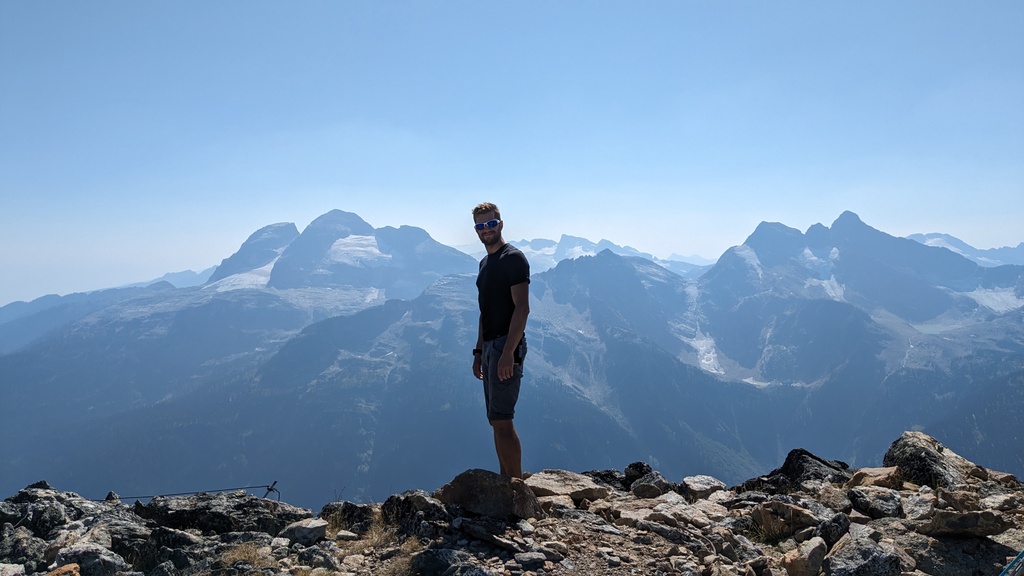
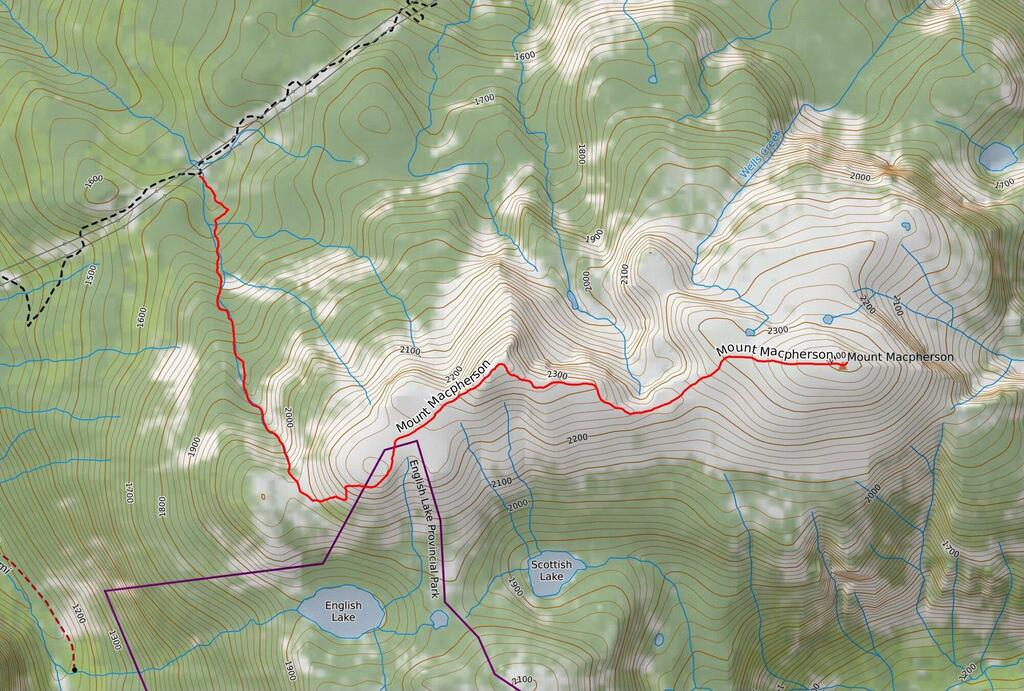 Mount MacPherson from the west ridge (gpx).
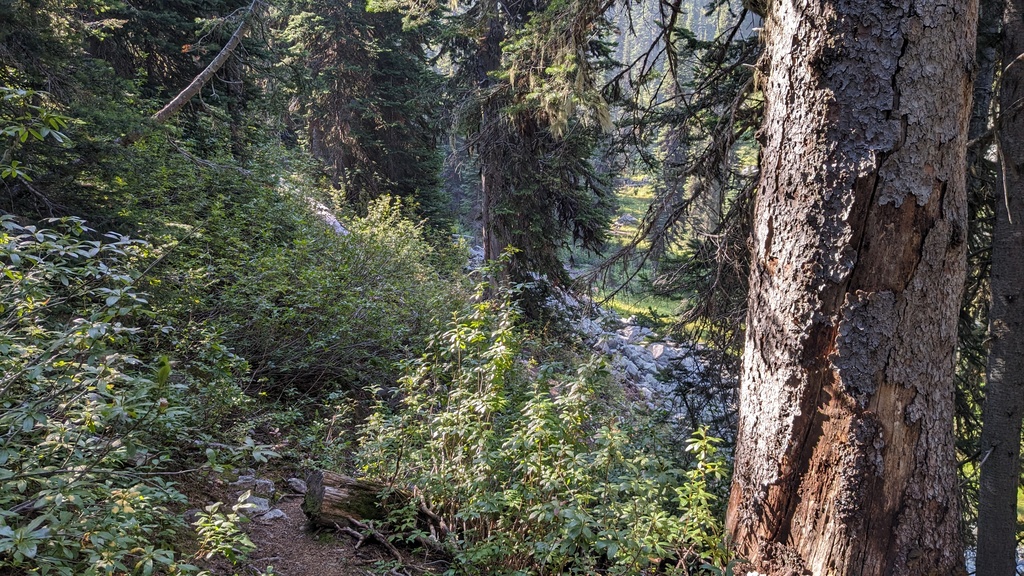
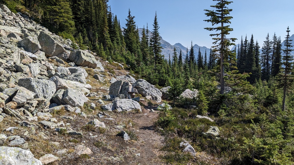
The start of the trail was relatively easy to find, with a cairn and some wooden pegs propped up by some rocks. The first part of the trail was through low brush in what was probably an old cut block. As it entered the forest, we started ascending. The trail was in pretty good condition. Some blowdowns, and probably not traveled that often, but easy to follow.
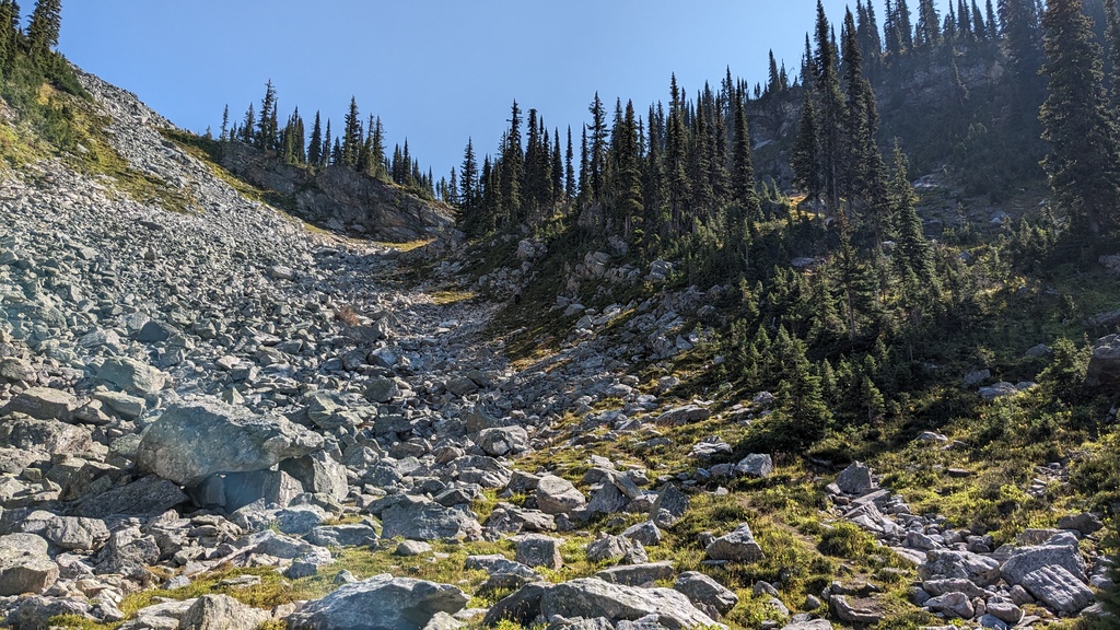
The first third of the trail has you gain most of the elevation, following a creek up the mountain. The creek didn’t have very much water in it, but I can imagine that it would be much different in the spring.
 Forest. Lots of it.
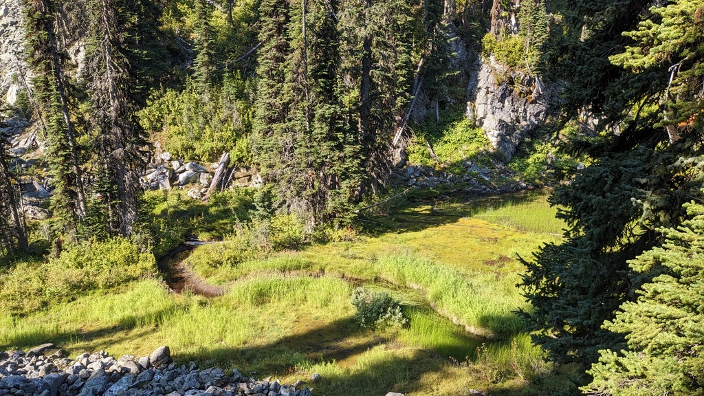 A short respite from the elevation. This is probably a pond in spring.
The creek makes its way up a steep gully. We lost the trail at one point, following a bunch of other people and/or animals into the forest, after which the trail disappeared. This required some bushwhacking to to the left to regain the trail. Always follow the creek.
Pretty soon we got to the saddle, which was mostly open alpine meadow with forest all around. This afforded us a lovely view of Mount English, with its impressive glaciers. This part is very pleasant walking. Eventually, we arrived at a left turn, with some talus on the left, and more forest.
 Looking back to the north. It’s not too visible here, but smoke definitely
limited the views to the north.
Looking back to the north. It’s not too visible here, but smoke definitely
limited the views to the north.
 The view of Mount English to the south west.
 Turn left here, and head up the slope into the forest.
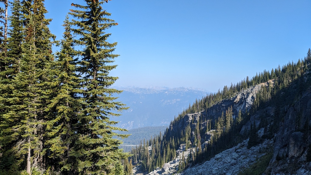
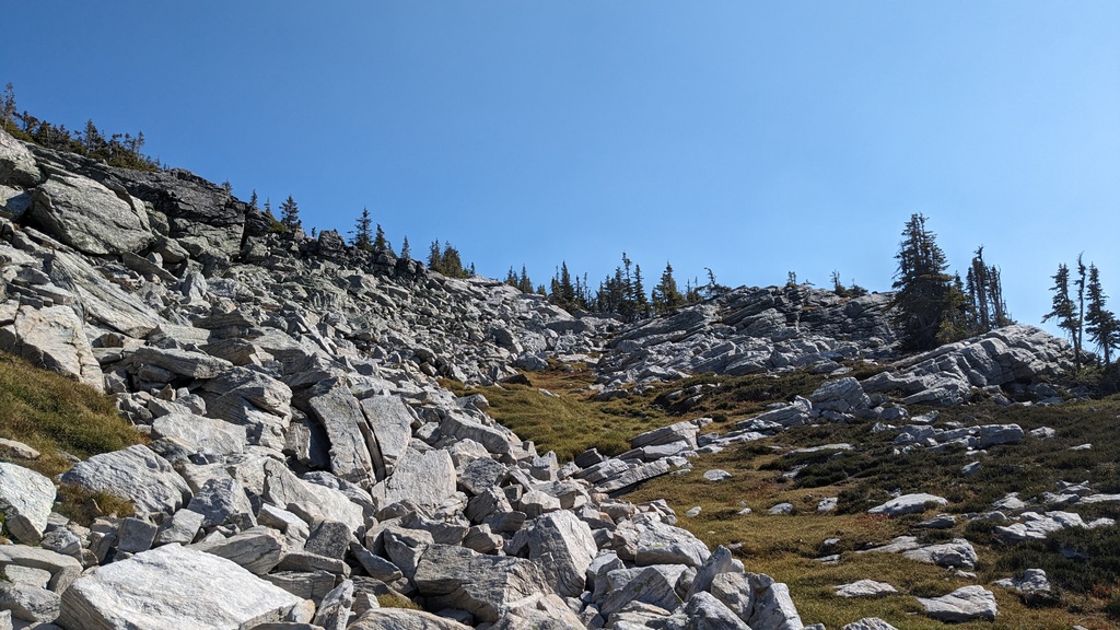
After a short stint in the forest, we arrived at a talus slope. The trail is hard to follow here, but at the top of the talus slope I spotted a cairn, under some trees. There are trails on both sides of the small tree patch, leading up to the last gully before gaining the ridge. This is probably the “crux” of the route, although it’s not more than class 2 scrambling.
After this was more pleasant walking on grass and some boulder fields, skirting around the south and east of the sub peak. Finally on the ridge, we got great views of some of the other, larger peaks in the Gold Range.
 Boulder fields above the gully.
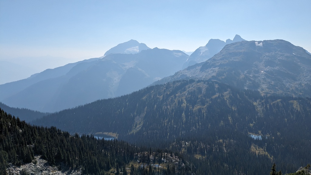 Mount Begbie on the left, and Mount Tilley behind the unnamed sub peak in the
foreground. We could also see Scottish Lake on the left, with another smaller
unnamed lake on the right. Further to the right would be English Lake.
Mount Begbie on the left, and Mount Tilley behind the unnamed sub peak in the
foreground. We could also see Scottish Lake on the left, with another smaller
unnamed lake on the right. Further to the right would be English Lake.
The ridge continues west and slightly north. There isn’t really a path here for large stretches, but it doesn’t matter much which way you go. We aimed for the large sub peak to the north east, which has an elevation of 2384m. There are several options for light scrambling here, although it isn’t necessary.
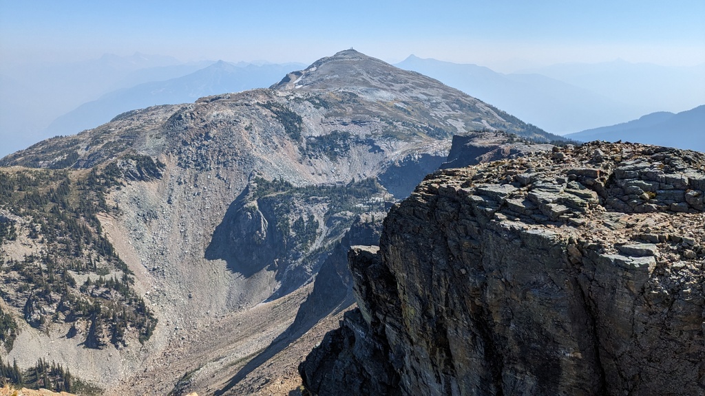
From the top we could see Mount MacPherson, our objective. There was some impressive terrain between us and the peak. However, it’s all easily navigable, especially with the weather we had.
Even though the intermediate peak on the ridge is nearly as large as Mount MacPherson, there is still a decent amount of elevation loss and gain to the peak, which adds a big chunk to the overall numbers.
 Impressive cliffs between us and Mount MacPherson.
The peak itself had three green telecommunications installations on it, and a wooden platform. The views of Mount Begbie to the south were fantastic. Views to the north and east were less impressive, likely due to the smoke. It wasn’t really possible to see much of Glacier National Park.
 From left to right: Mount Begbie, some guy (me), Mulvehill Mountain
(background), Mount Tilley, and Mount Davis (background).
From left to right: Mount Begbie, some guy (me), Mulvehill Mountain
(background), Mount Tilley, and Mount Davis (background).
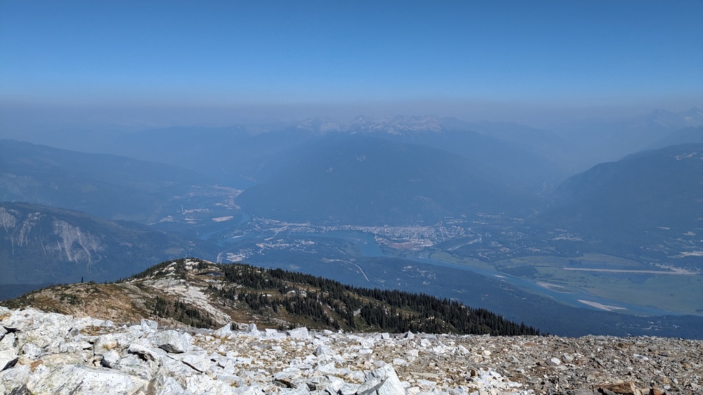 View of a smoky Revelstoke from the summit.
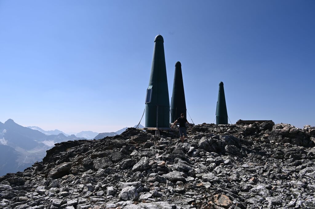 The telecommunications equipment on the summit. There were a number of these,
also at lower elevations and on the sub peak.
The telecommunications equipment on the summit. There were a number of these,
also at lower elevations and on the sub peak.
The way back took a while (trail-less travel can be somewhat slow going!). We tried to skip summitting the sub peak on the ridge a second time by skirting around it to the south, but the hillside is brushy in some areas and has some micro terrain, so we ended up going to the top anyway, which is probably faster.
The way back to the trailhead was largely uneventful. All in all it was a very pleasant day out, and it was nice to be back in the alpine.
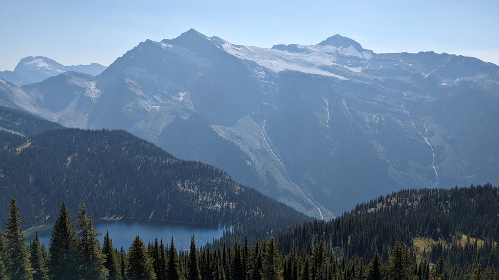 English Lake with Mount English in the background.
 Looking back up at the creek and talus slopes on the descent.